Practice & Industry Groups
Overview
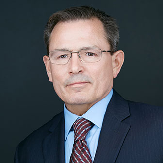
Chris Smith serves as the firm’s Geographic Information System (GIS) Director. He supports all practice areas through comprehensive GIS analysis, data modeling, high-quality map exhibits, data conversion and manipulation, research/forensic mapping, legal descriptions, developing interactive web mapping applications, and 3-D technology for analysis and visualization.
Chris’s multiple industry background and experience working with diverse data types across all agencies and organizations, enables him to quickly understand how to best execute each task, whether it be data manipulation and analysis or visual illustration. Using GIS, Chris is able to facilitate understanding of complex situations that may otherwise require lengthy research and review to identify and address issues and formulate strategies.
Before joining the firm in 2015, Chris had over 25 years of industry experience including a position at a civil engineering firm in aerial mapping, as project manager for the Source Water Assessment and Protection Program with the Florida Department of Environmental Protection, over seven years as a private consultant working for numerous disciplines such as planning, engineering, and environmental, and four years as a geologist in oil and gas exploration.
Notable Experience
- Developed interactive web maps for utilizing “Constraint Avoidance” to predict the most likely routes for the Multi-use Corridors of Regional Economic Significance (M-CORES) program. This data model incorporates seamless multi-county parcel level ownership and land use, Wetlands, Flood Zones, Easements, Conservation Lands, and Environmentally Sensitive Areas (ESA’s) GIS layers.
- Compiles and analyzes assessment data for Ad Valorem Group. Methods include comparison of similar property assessments, Improved Value, Just Value, Primary Use, and identifying highest and best use limitations. This information can be integrated with other data types to identify compelling factors or conditions that are not apparent otherwise.
- Acquires and converts data from the Department of Business and Professional Regulation into database format where the information can be refined and geographically located for efficient and meaningful analysis.
- Engineered an automated data integration tool that transforms and combines over 24.5 million records comprised of property parcels, tax roll data, sales data, and land use descriptions. The resulting dataset merges property appraiser data from 67 Florida Counties into a single searchable parcel layer for statewide statistical analysis.
- Creates and deploys custom webmapping applications. Examples include Executive Order Permit Extension Tracker, Qualified Opportunity Zone Locator, and client specific secured map based document management systems.
- Data integration, i.e., combining a local city Future Land Use and Zoning map with legal descriptions from Official Records, Storm Surge extents from FL Emergency Management, historical aerials from the FLDOT, potable water system CAD drawings from a local utility owner, and Flood Zones from Federal Emergency Management.
- Engineered a proprietary “in-house” data model that searches through over a half million property parcels to optimally locate the shortest distances to Bus and Rapid Transit Stops, Medical Facilities, Schools, Pharmacies, Grocery Stores, within Qualified Census Tracts and an optimal Zoning density and acreage range, for vacant land suitable for multi-family development; an exercise that would require a team working for months to acquire is reduced to a few hours.
- Developed the first ever comprehensive state-wide Community Redevelopment Area (CRA) GIS data layer on a parcel-level. 316 boundary extents were compiled from numerous sources, including but not limited to: existing GIS layers, hard copy maps, photos, and legal descriptions.
- Produced exclusive high resolution state-wide statistical models using COVID-19 data at County and Zip Code levels for hospitalizations, week-over-week infection rates, and percent of population.
- Engineered a partially automated workflow/tool for converting legal descriptions from document to map in a fraction of time required using conventional methods.
- Experience utilizing 3-D technology for analysis and visualization including building variances within height restriction zones, comparison of surrounding building heights with proposed construction to illustrate conformance with existing structures, analysis of sun angle and the effects of shadows throughout the day and year, and land use restrictions based on airport flight paths. These illustrations and analysis have been a valuable component in plan amendments, infrastructure approval, and addressing objections to proposed developments.
Other Industry Experience
- Currently serves as data steward at no cost to local government and private clients to store and manage their data safely and effectively.
- Geologist in the ultra-deepwater oil & gas prospects in the Gulf of Mexico and North Sea off of Aberdeen Scotland.
- 7 years as a private consultant working for numerous disciplines such as planning, engineering, and environmental. Management of an entire county’s GIS system, political re-districting, feasibility studies, needs analysis, countless Land Use Amendments, city and county-wide comprehensive plan mapping, DRI’s, site plans, data management and conversion with CAD and GPS data collected for Wetland Mitigation, Natural Feature Inventories, Listed Species, and Phase I Assessments.
- Project manager for the Source Water Assessment and Protection Program with the Florida Department of Environmental Protection. Served as liaison between the Division of Division of Water Resource Management and Waste Management. Tasked with employing mobile/GPS in addition to internet GIS applications and then training individuals statewide to verify, correct, or field collect GIS point data with the aid of aerial imagery for more than 150,000 potential or existing sources of groundwater contamination. Worked with vast datasets, limited resources, and time constraints.
- Used GIS to capture and manage location data used for groundtruthing aerial imagery and mapping at civil engineering in the Florida panhandle.
- Worked for the Florida Geological Survey in aquifer delineation.
Credentials
Education
- B.S., Geological Science, Florida State University
Professional & Community Involvement
- Seven Hills Regional Users GIS Group, 2001-Present
- Host, Free Open Source Software Group (FOSS), Tallahassee, 2019
- Florida State University Geological Society, President, 1999-2001
- Sylvester Comprehensive Cancer Center
- University of Florida (UF) Health Shands Children’s Hospital
- Hosts a monthly user group meeting of Government and Private GIS professionals
- Retired Open Water Scuba Instructor
- Former support cave diver for the National Geographic Society
